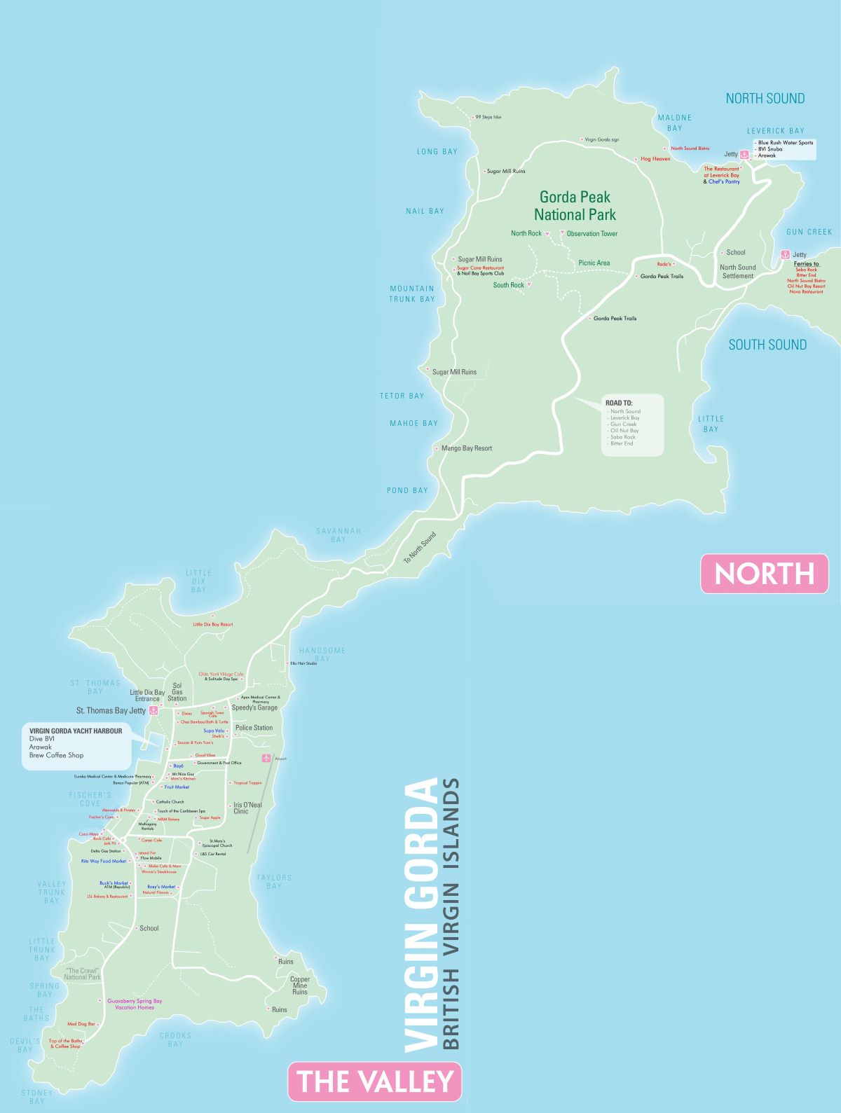
Map of Virgin Gorda
Virgin Gorda is the third largest and second most populous of the British Virgin Islands. It covers an area of about 8 square miles. Christopher Columbus is said to have named the island "The Fat Virgin", because the island's profile on the horizon looks like a fat woman lying on her side.
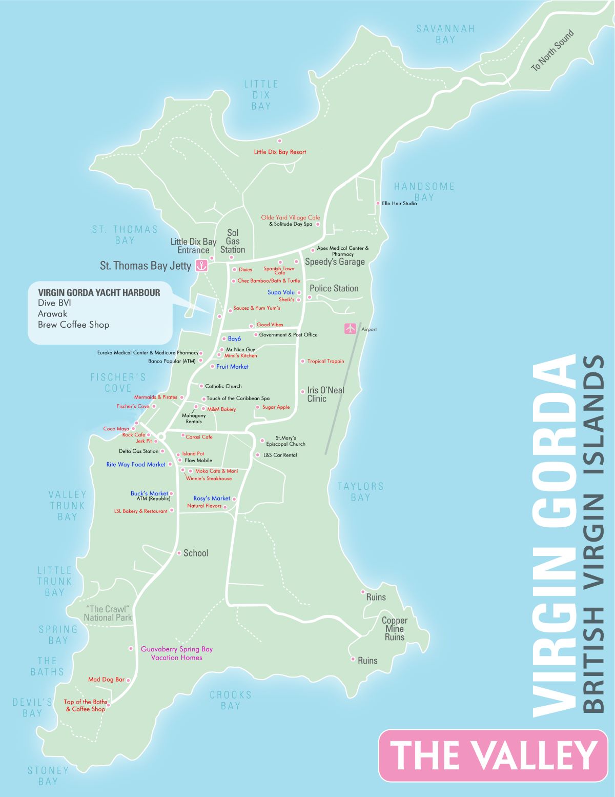
It can be divided into two very distinct sections, the mountainous north centered by Gorda Peak and the south commonly known as The Valley, a low rising peninsula. These maps will give you a feel for the layout.
Click these smaller maps for a larger view.